Photography by Mike Mander | The Ottobeuren Abbey

Welcome | Image Galleries | Info & More | Bio / Contact | Email

Germany - Day 7: The Abbey of Ottobeuren

August 21st

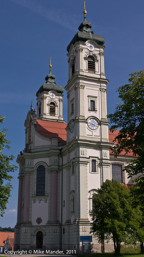
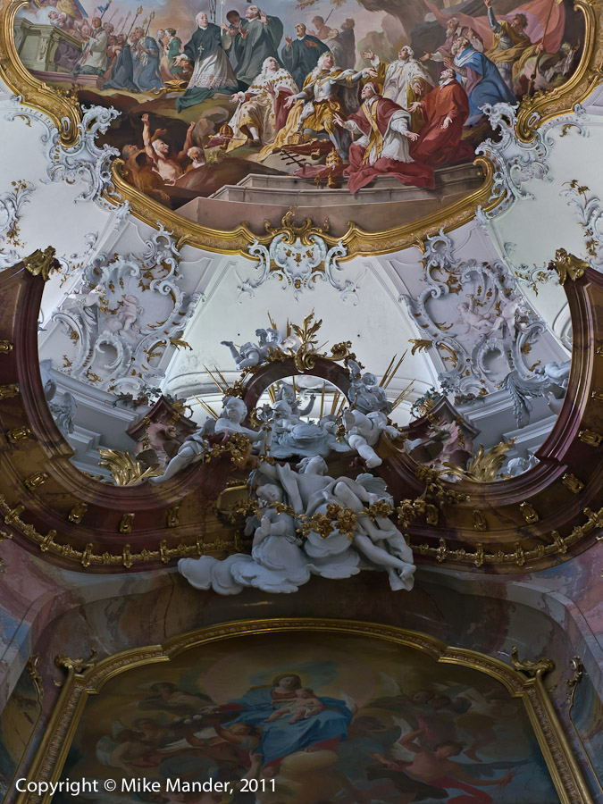
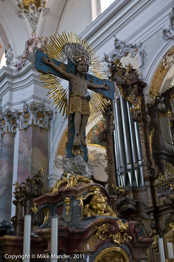
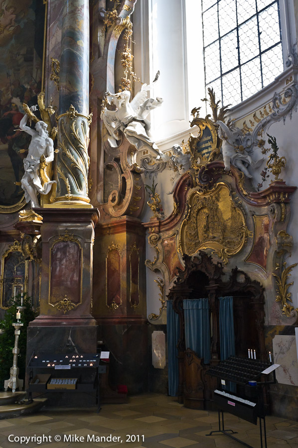
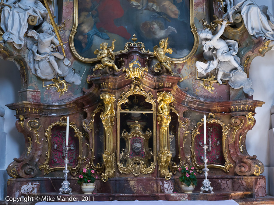
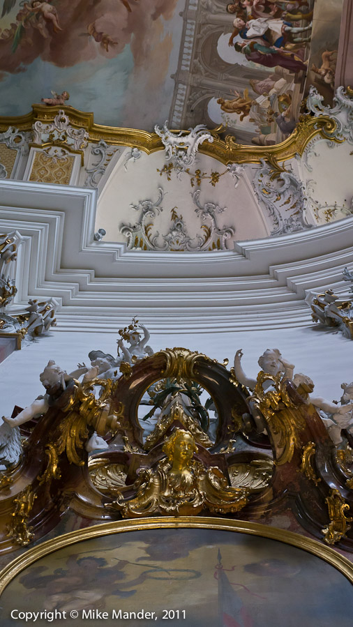
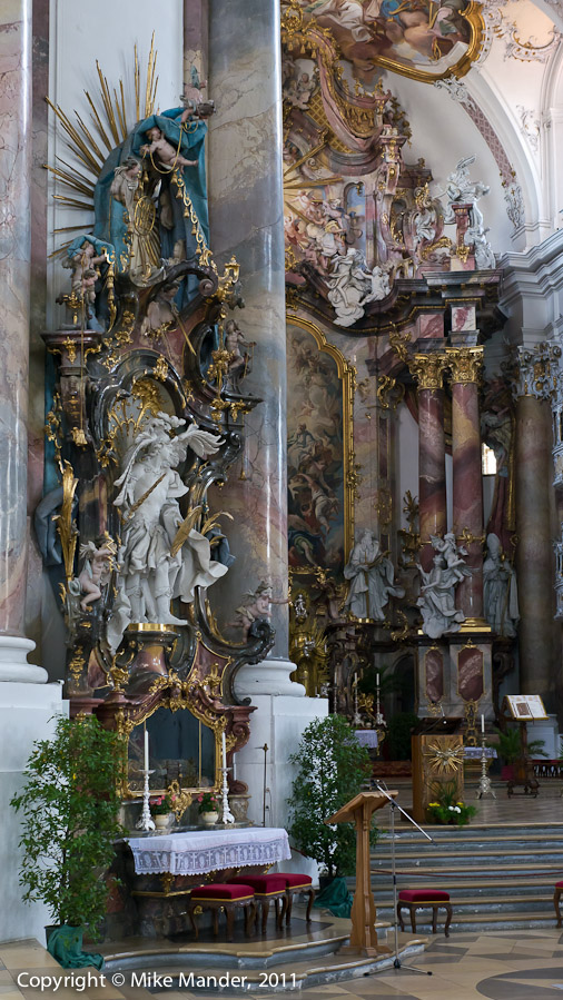
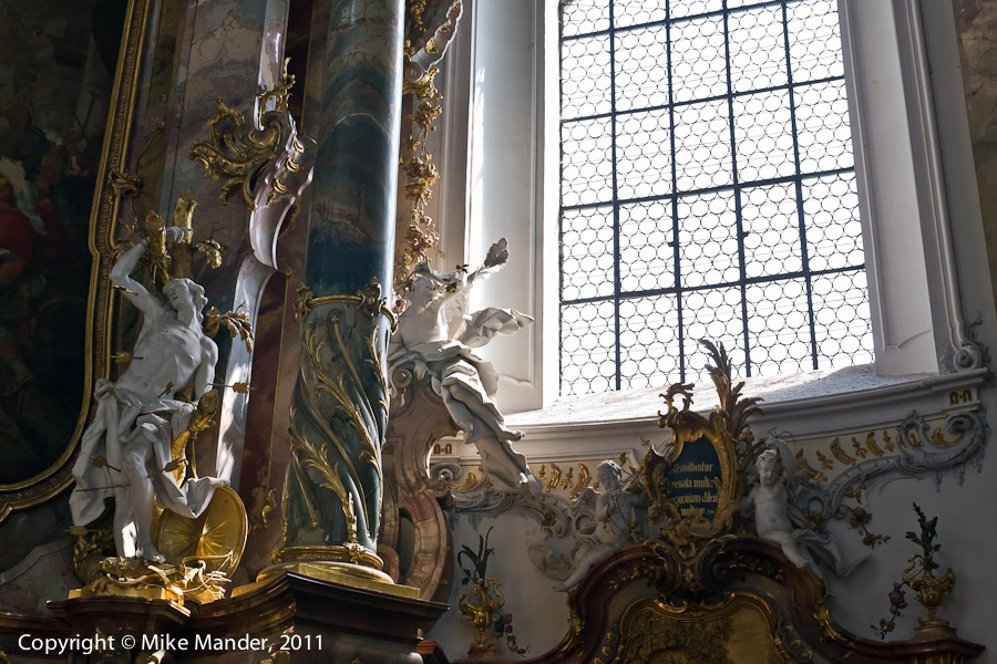
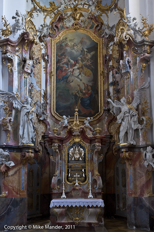
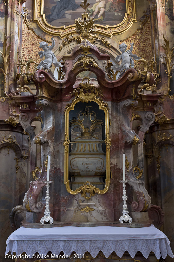
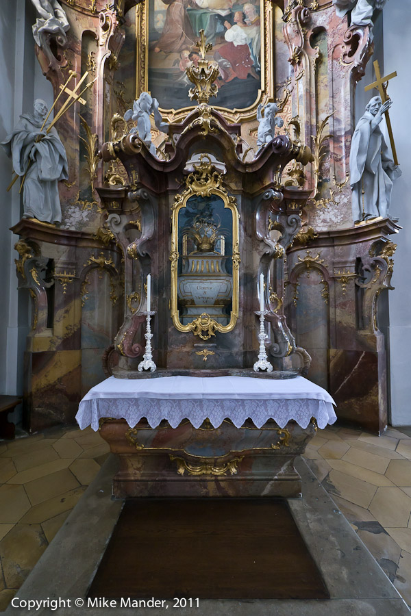
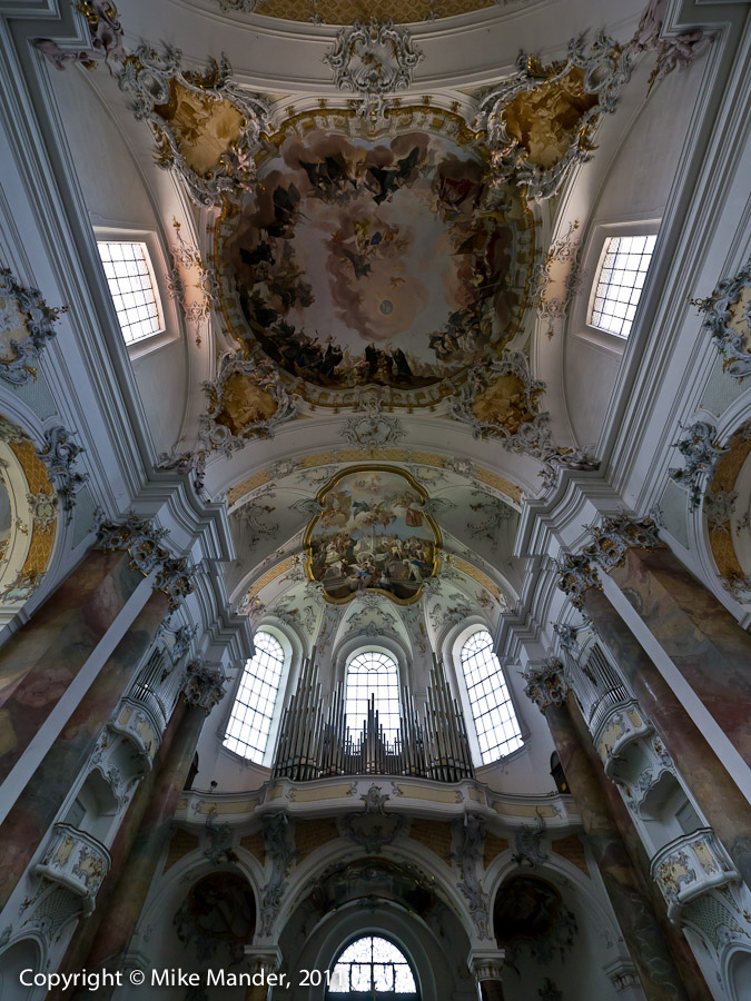
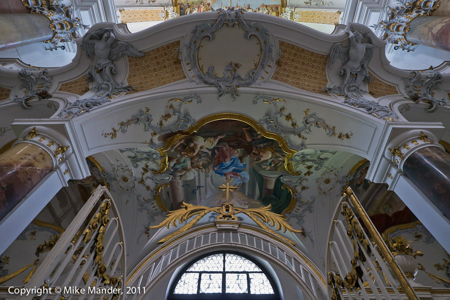
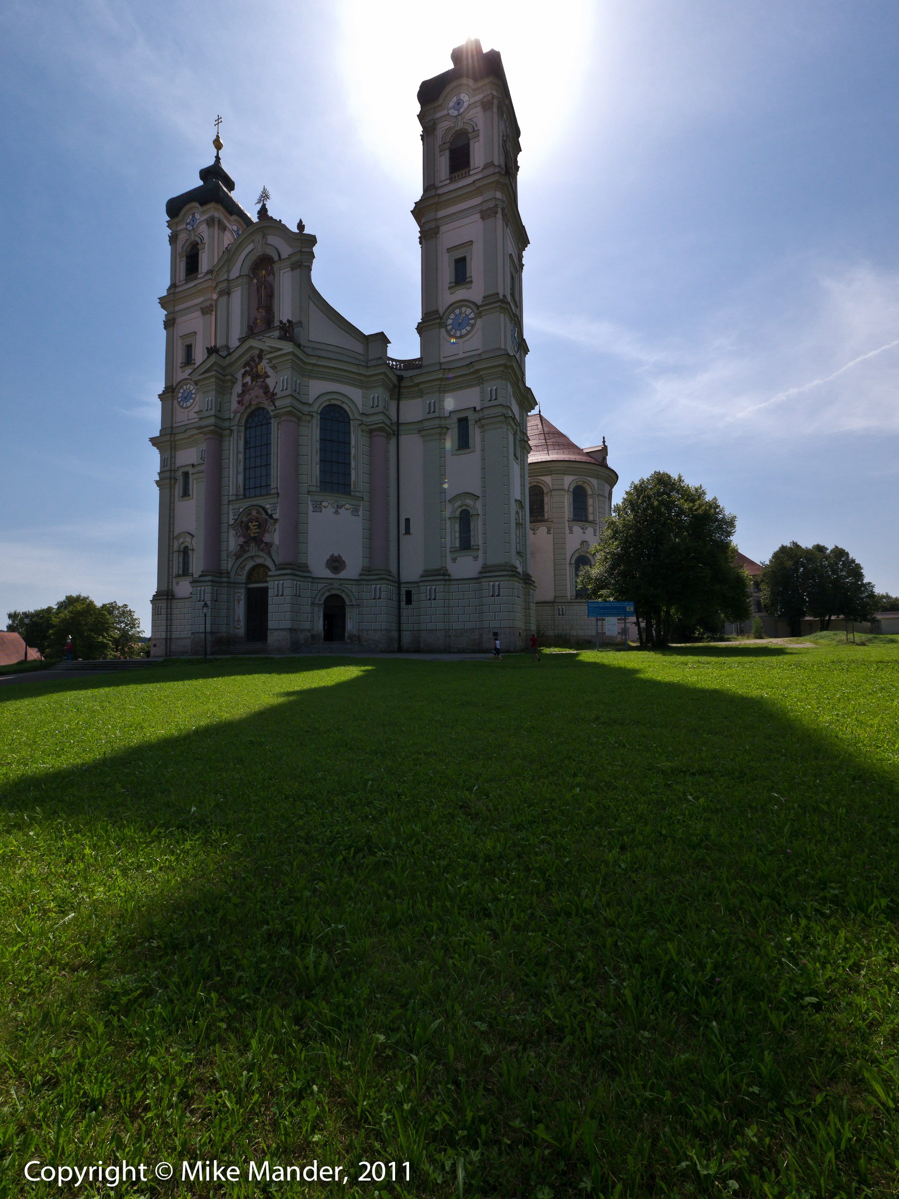
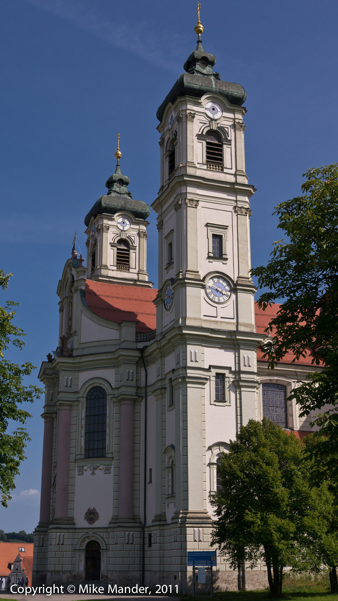
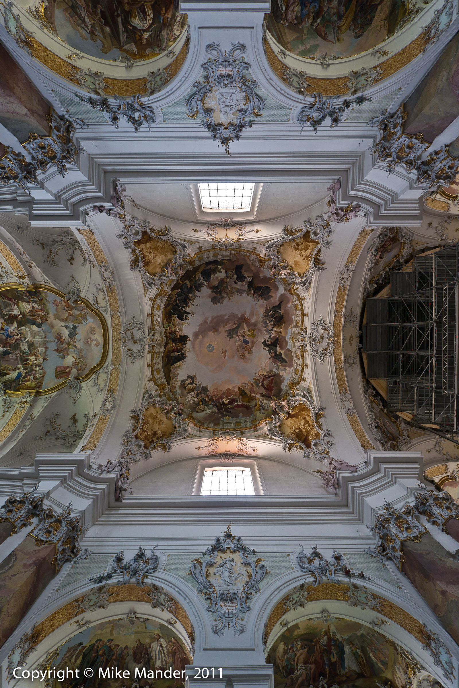
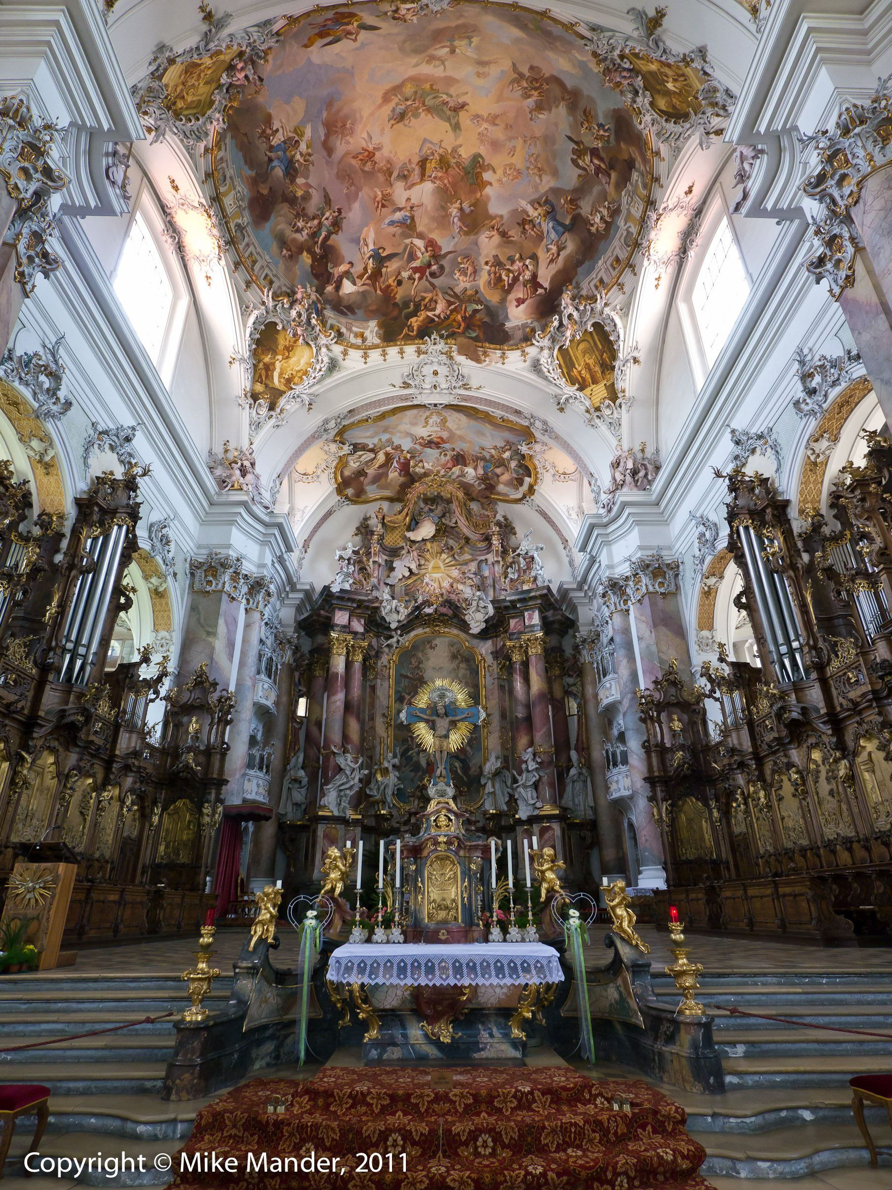
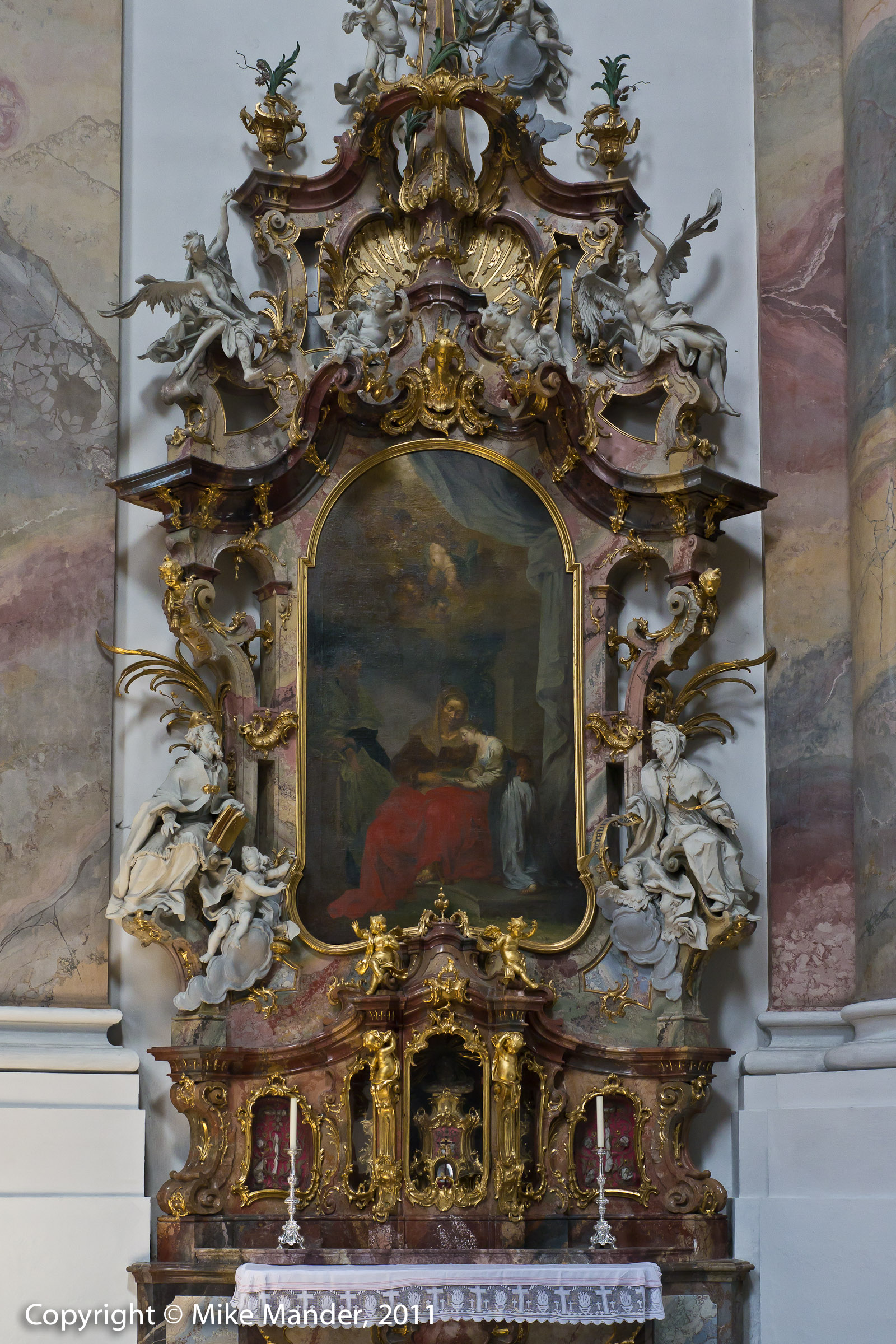
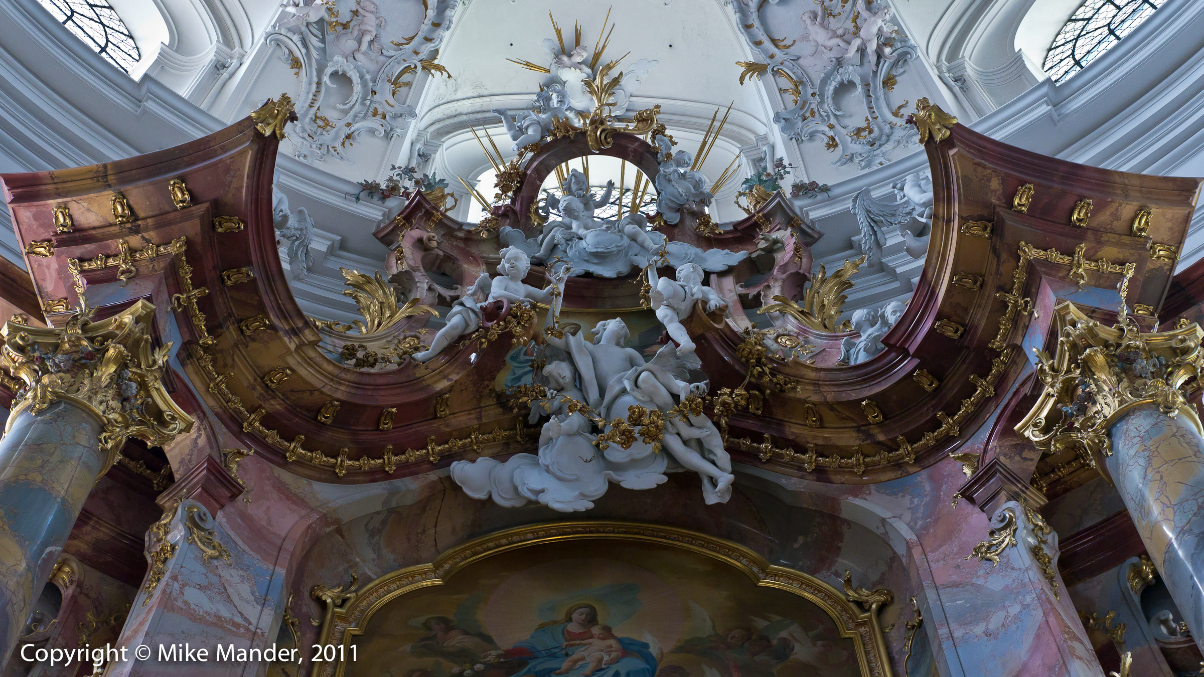
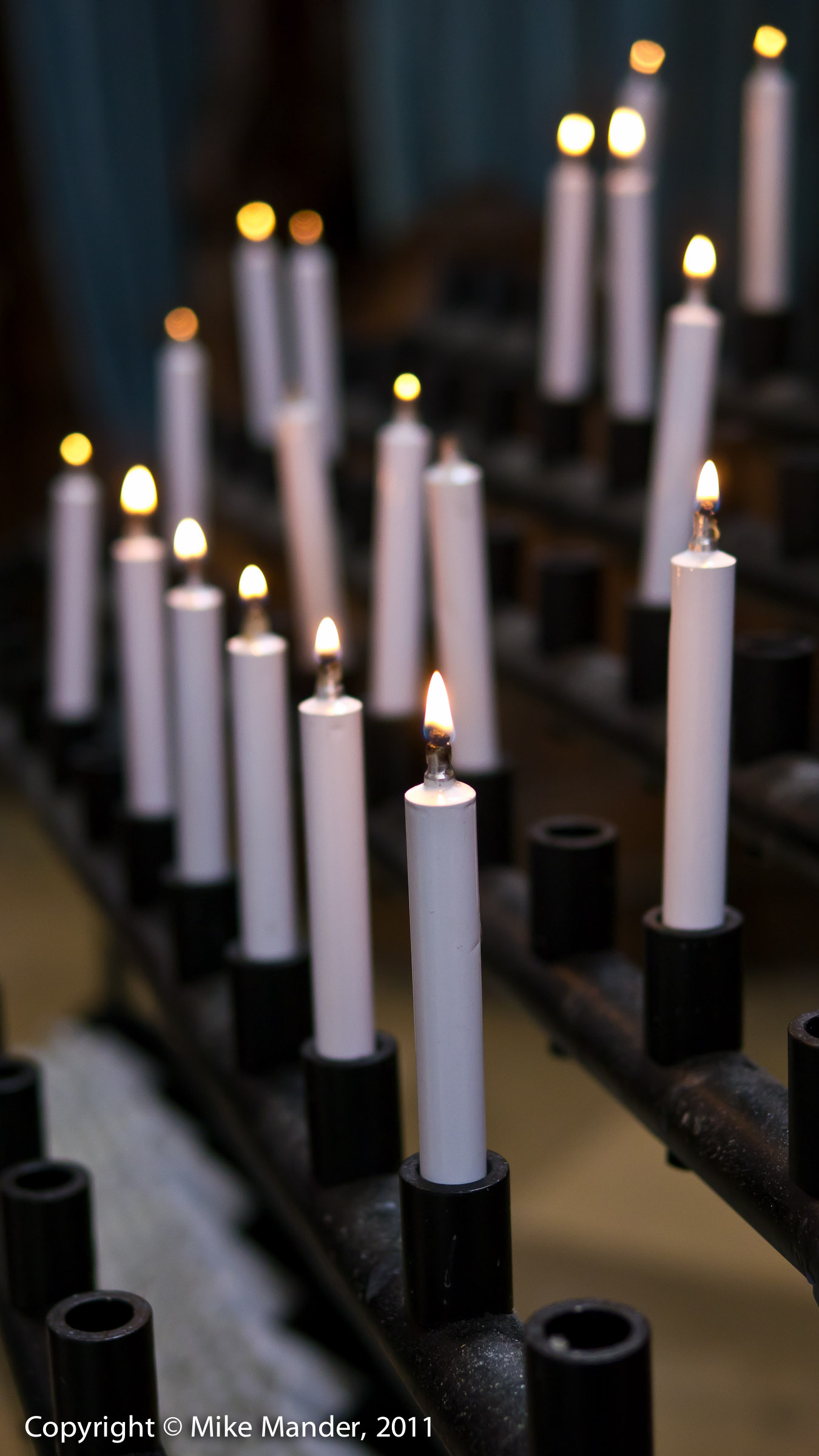
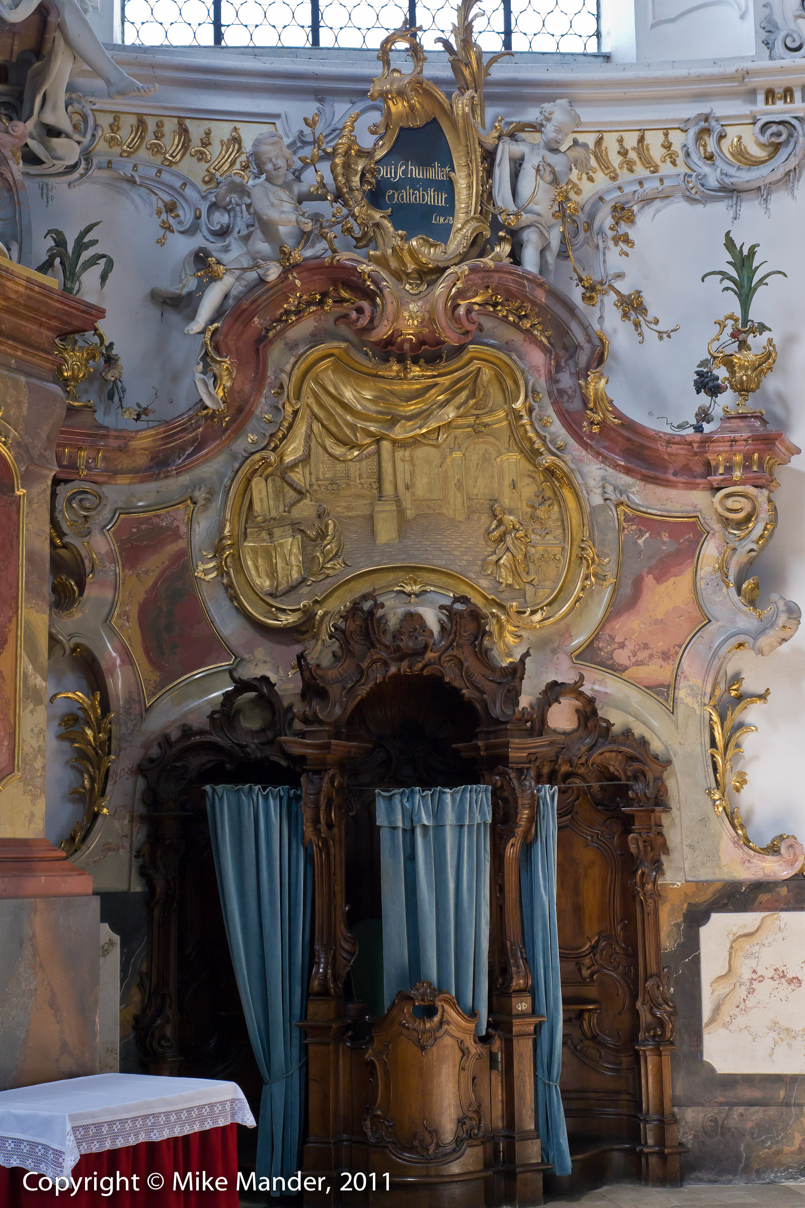
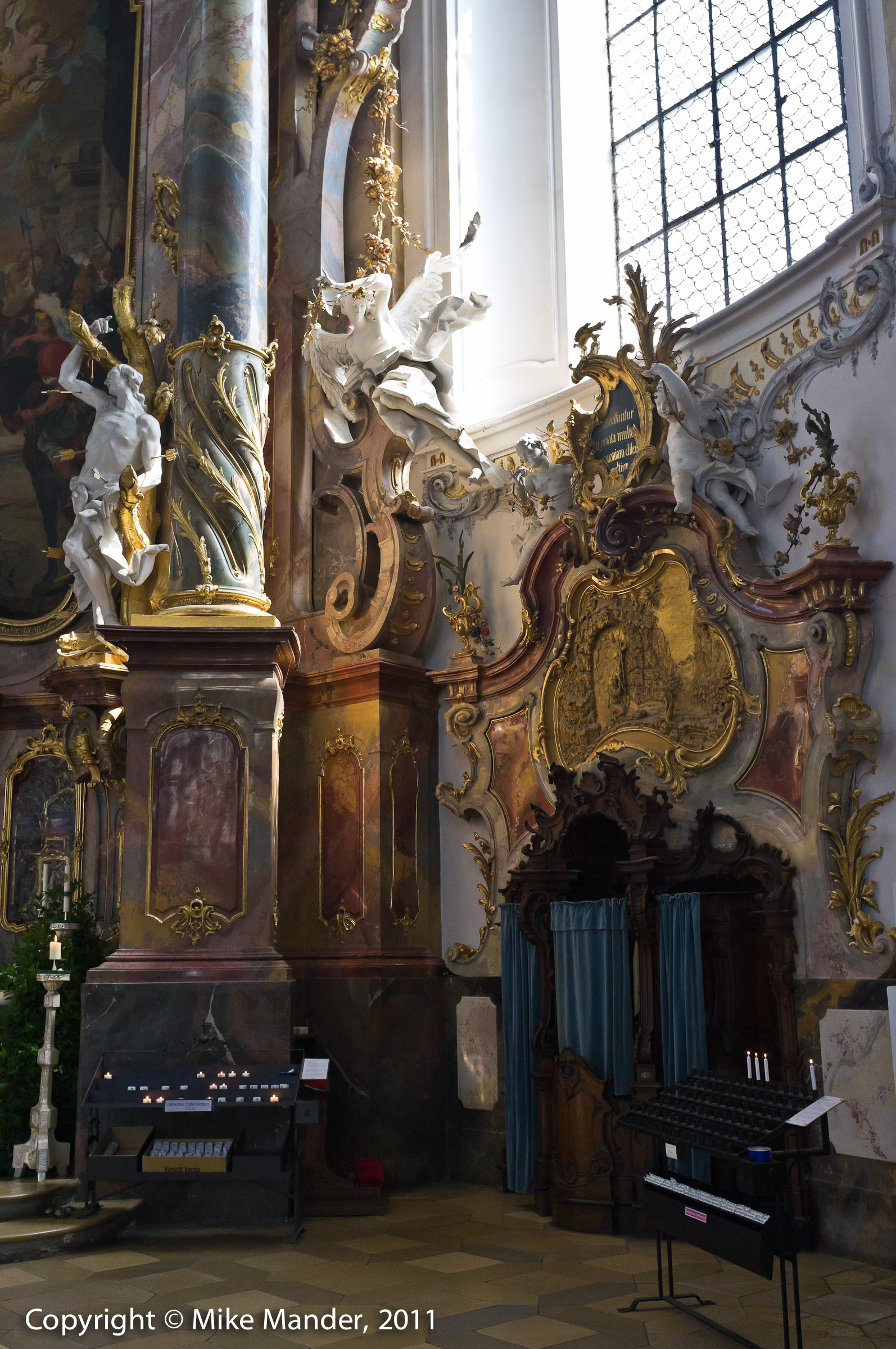
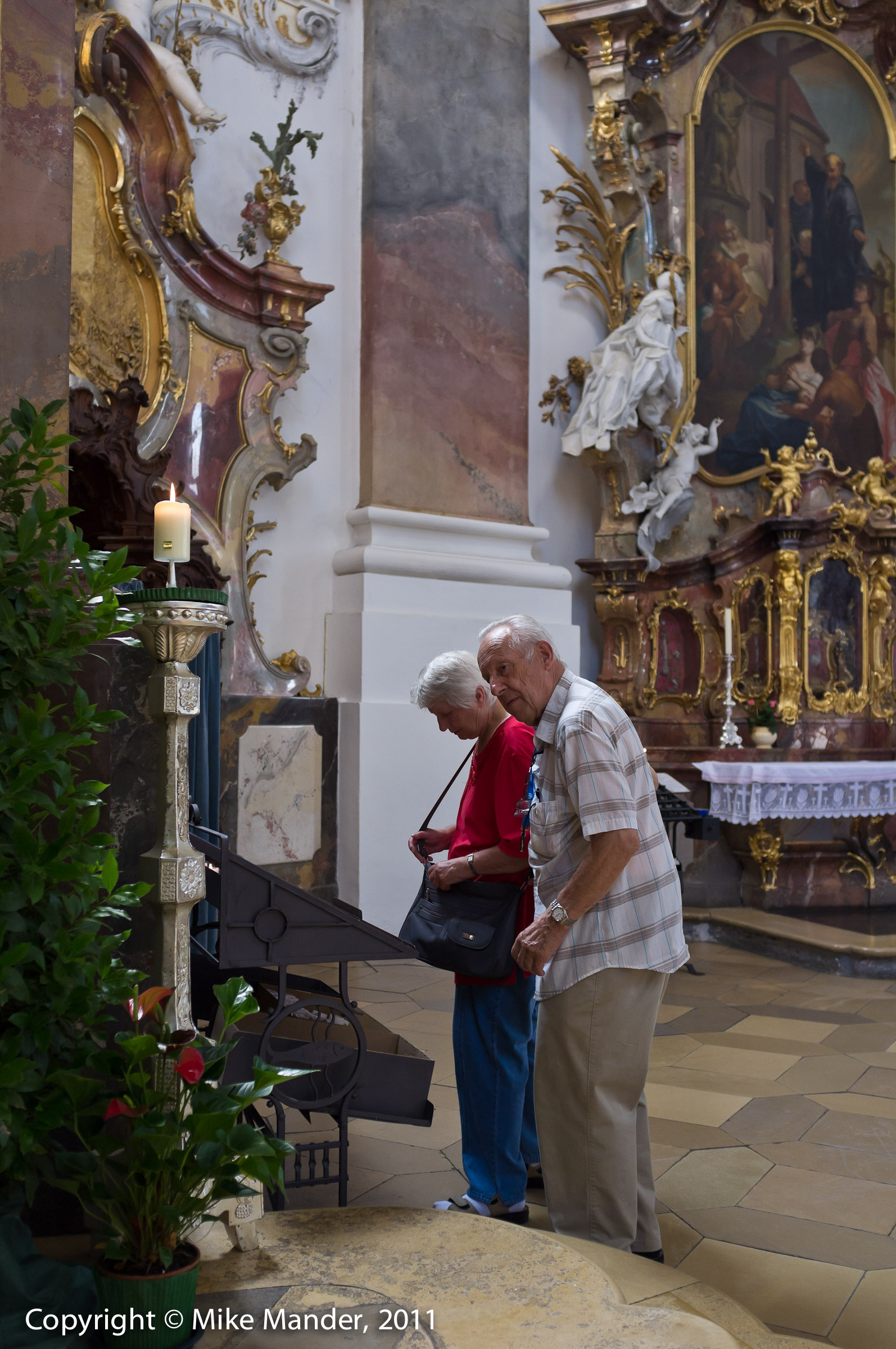
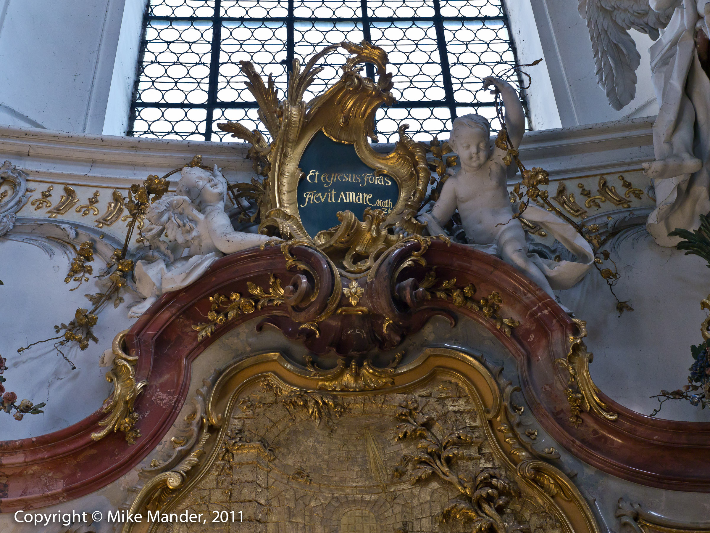
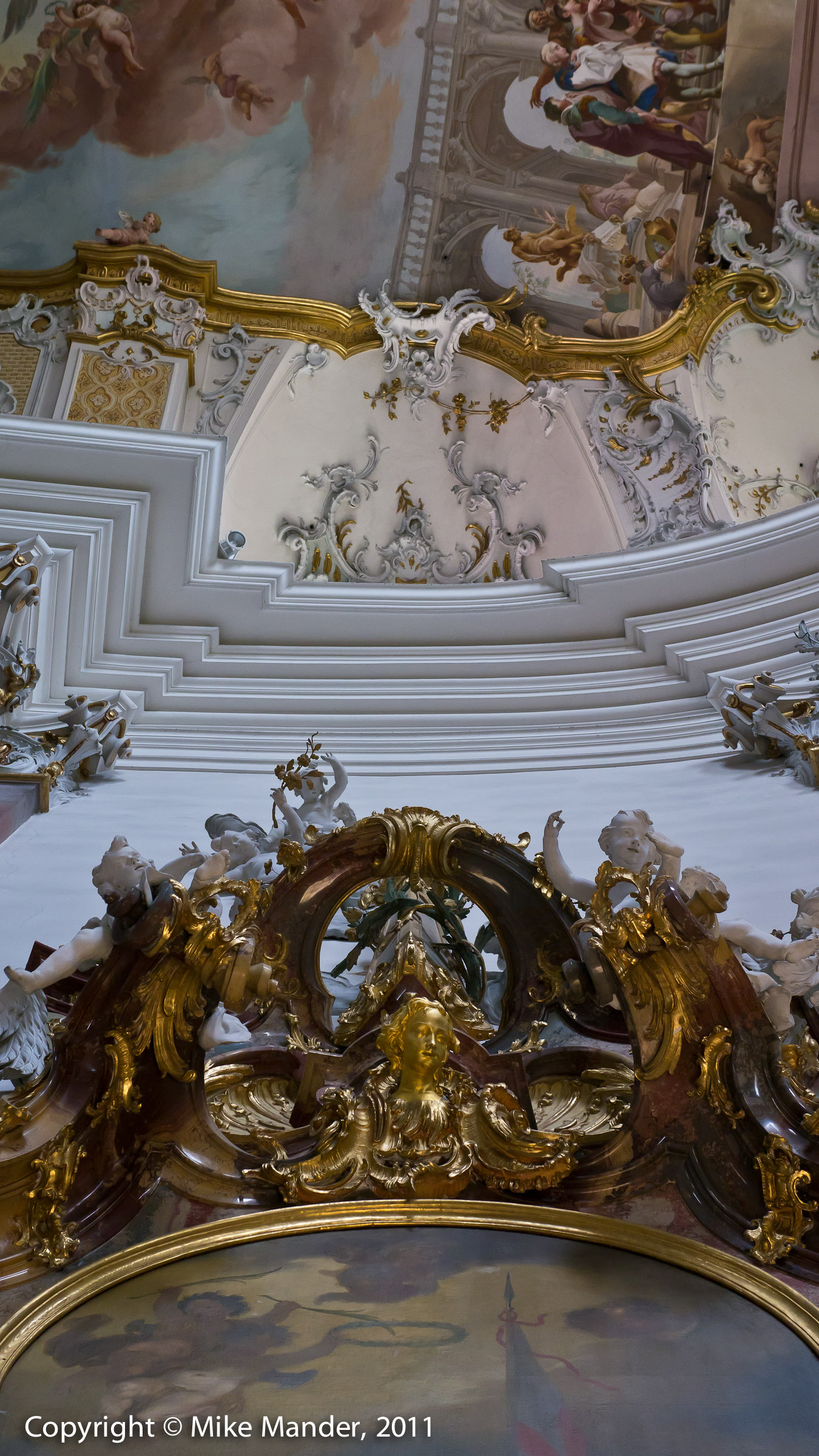
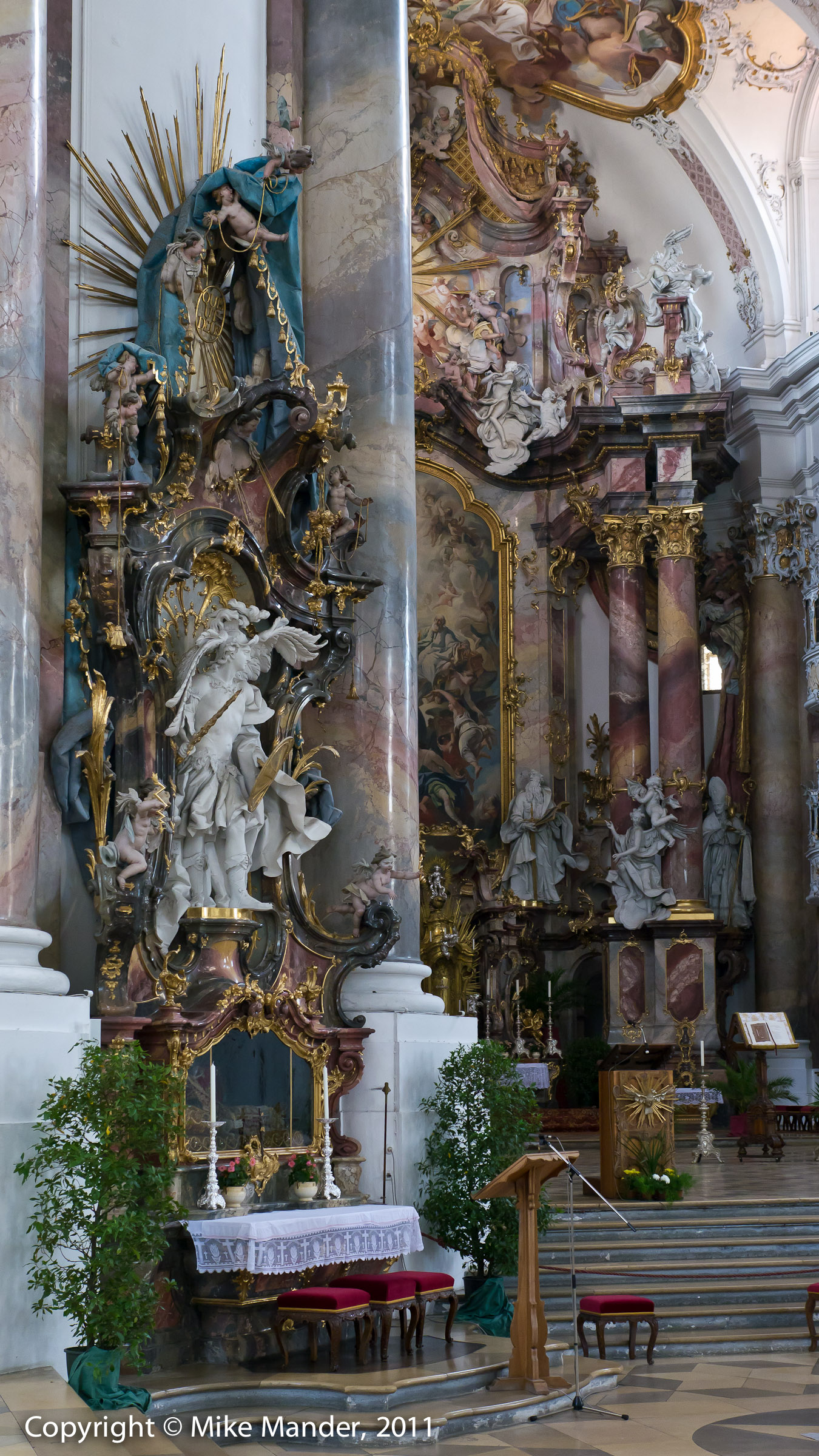
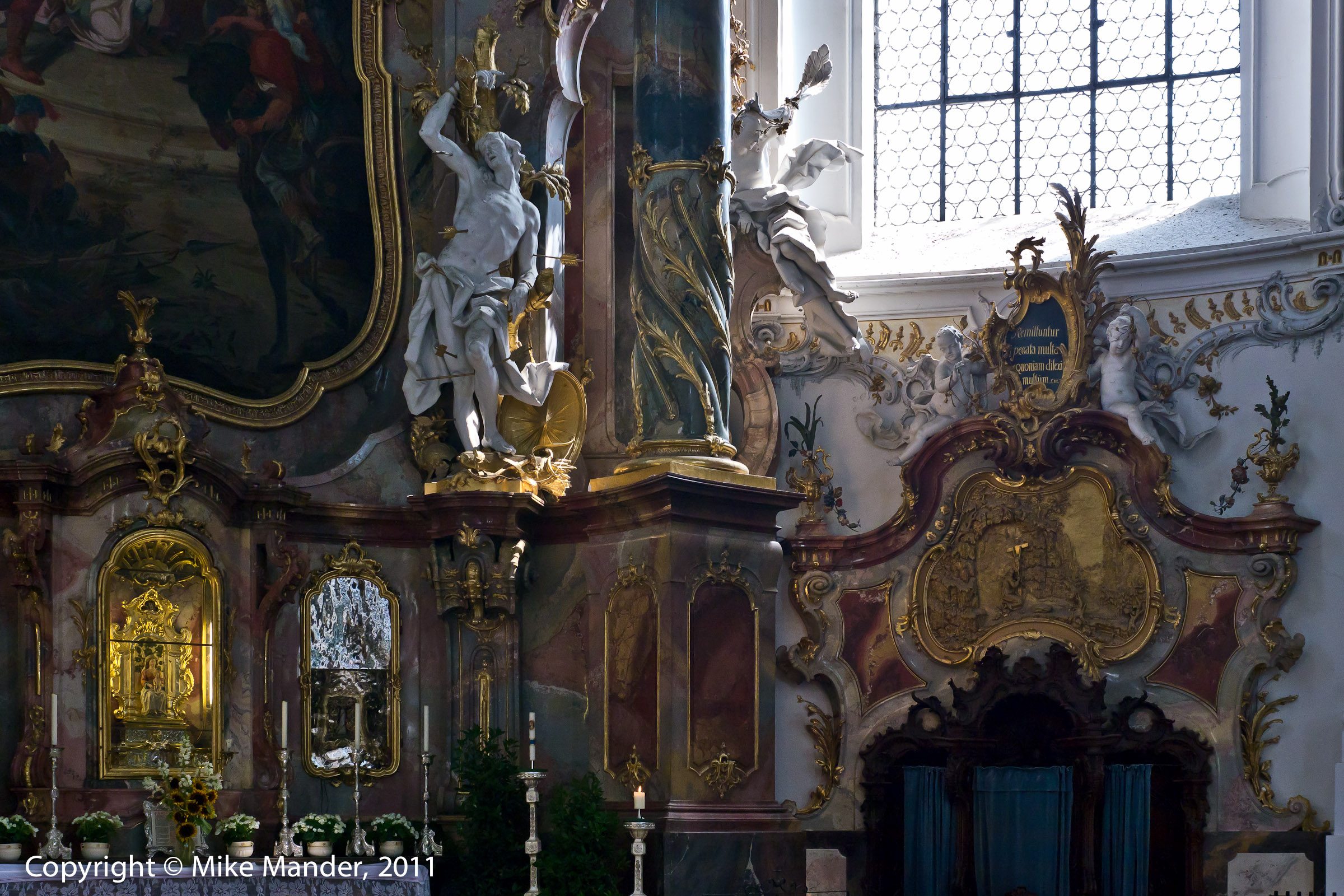
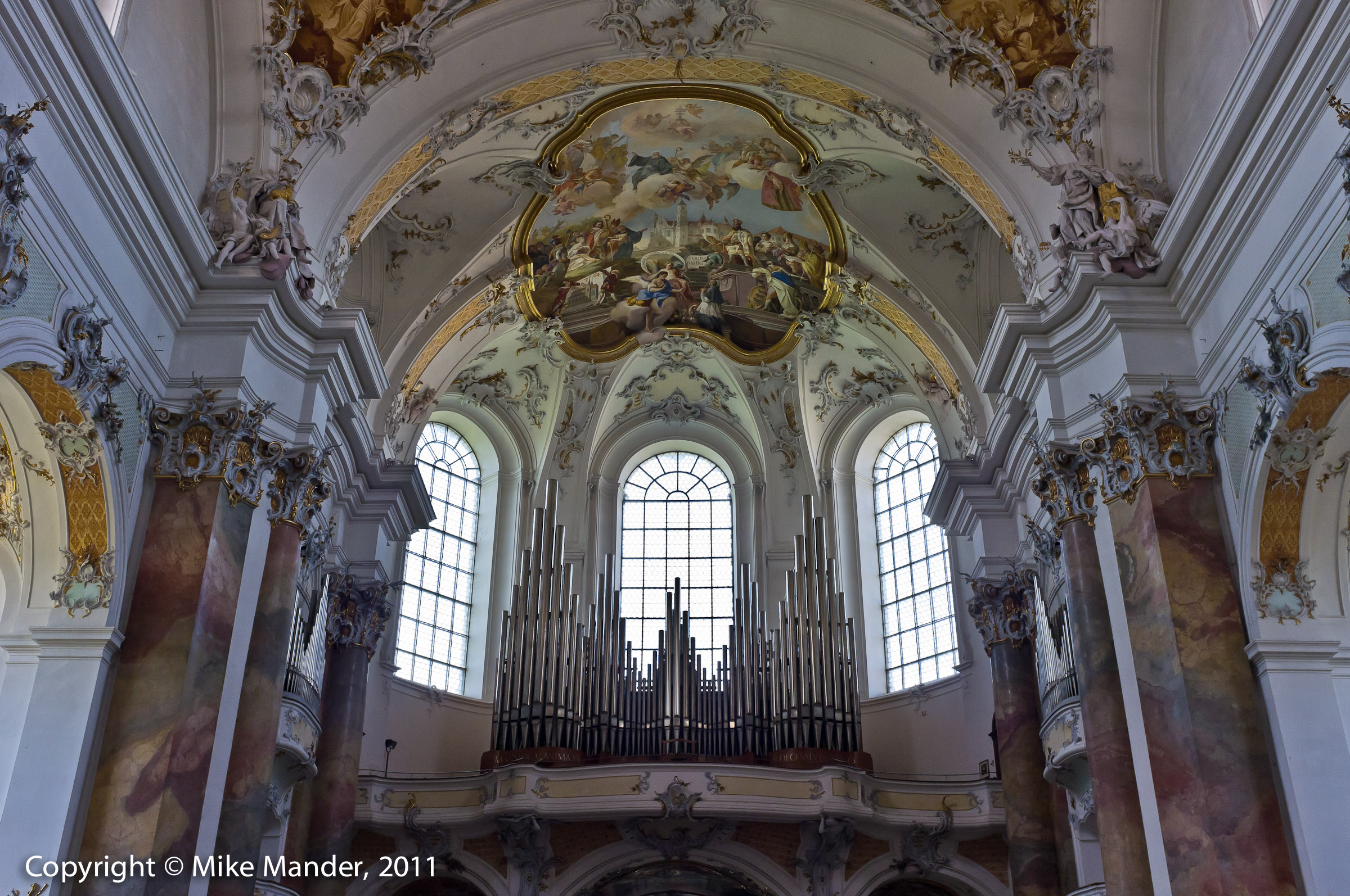
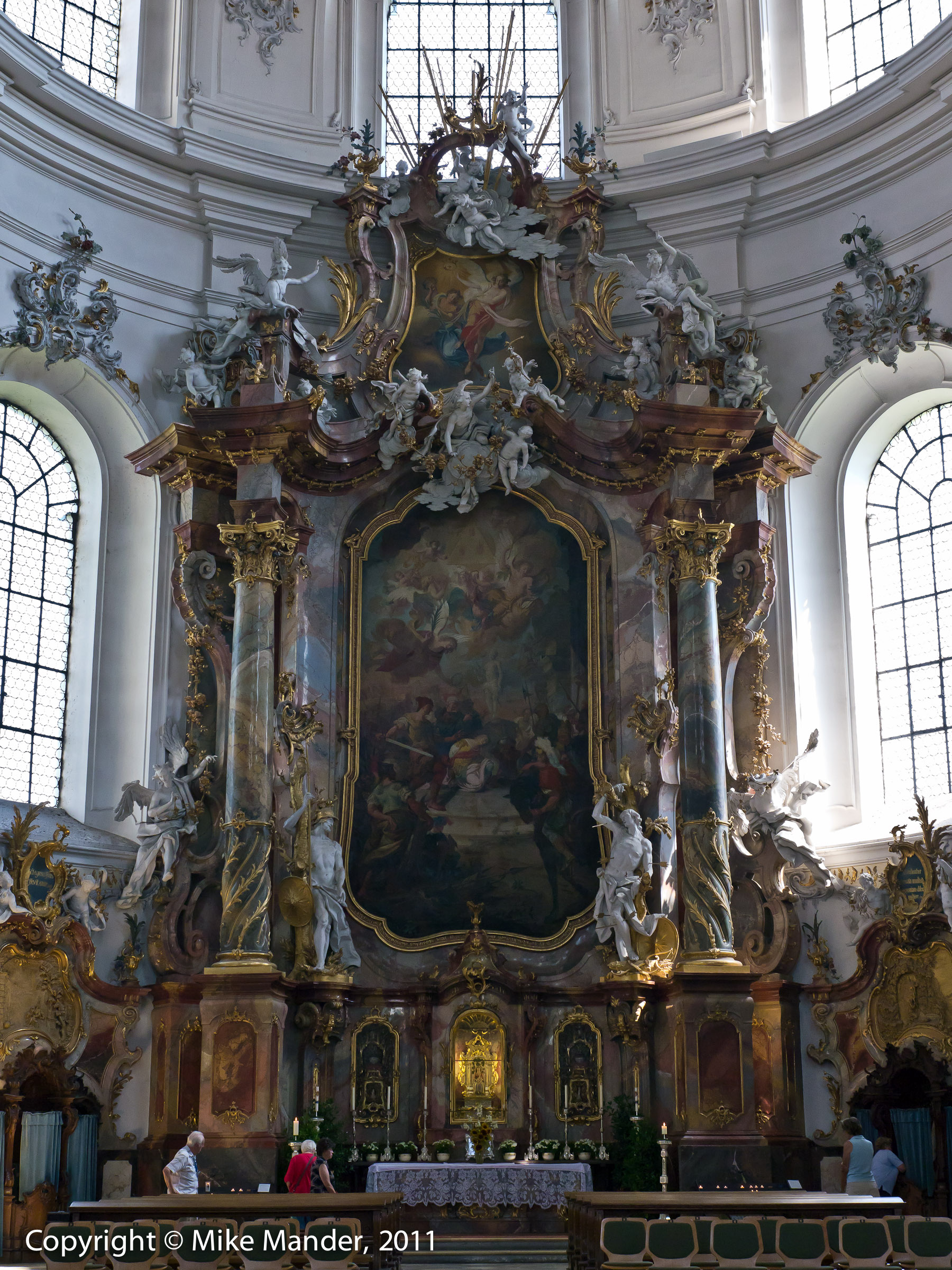
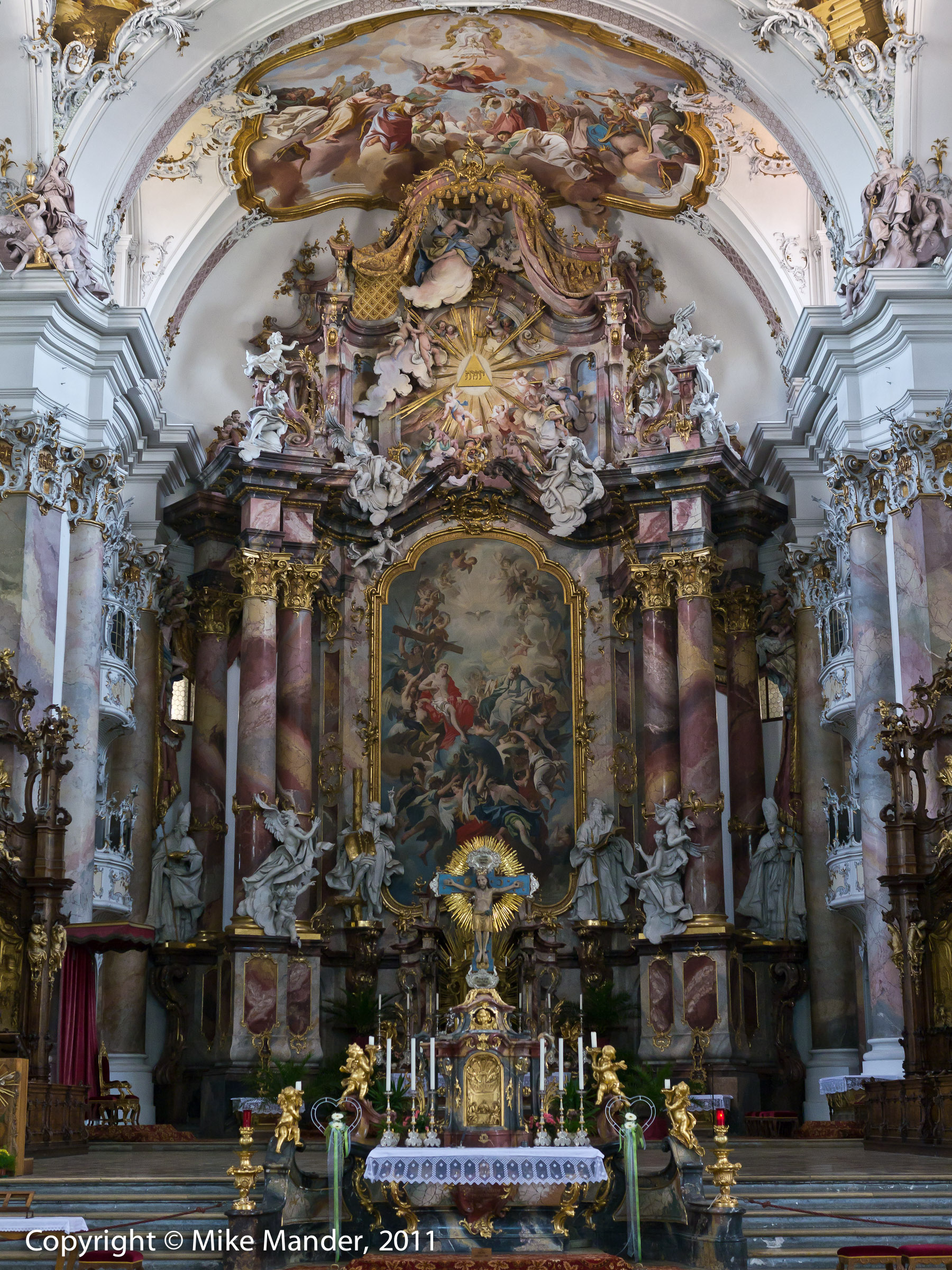
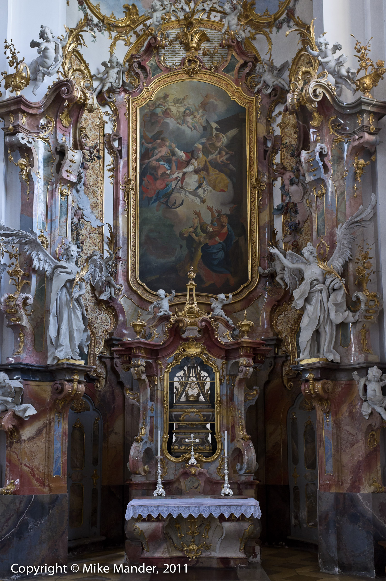
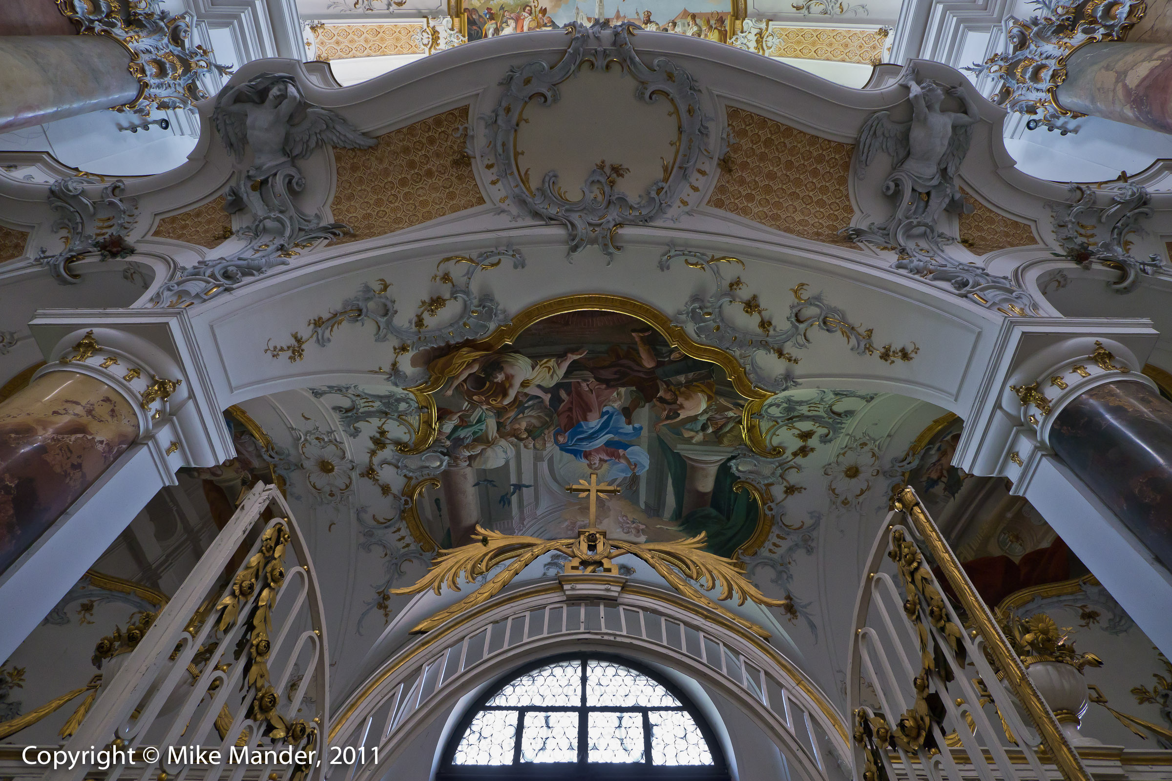
I thought this series deserves its own gallery. Although quite large, this Benedictine Abbey is unassuming from the outside and indeed, with its fresh and somewhat tacky paint job (fake stonework?!), one might be forgiven for passing it by. However inside is totally another story. Maybe some would find it tacky too, but the extraordinary amount of exquisite detail that this church contains, is something I do find remarkable! I have made the high-res images fairly large so that you can appreciate all the amazing detail.

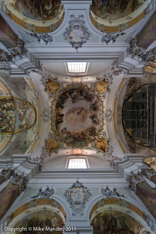
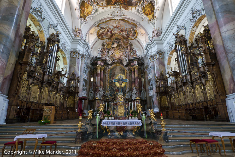
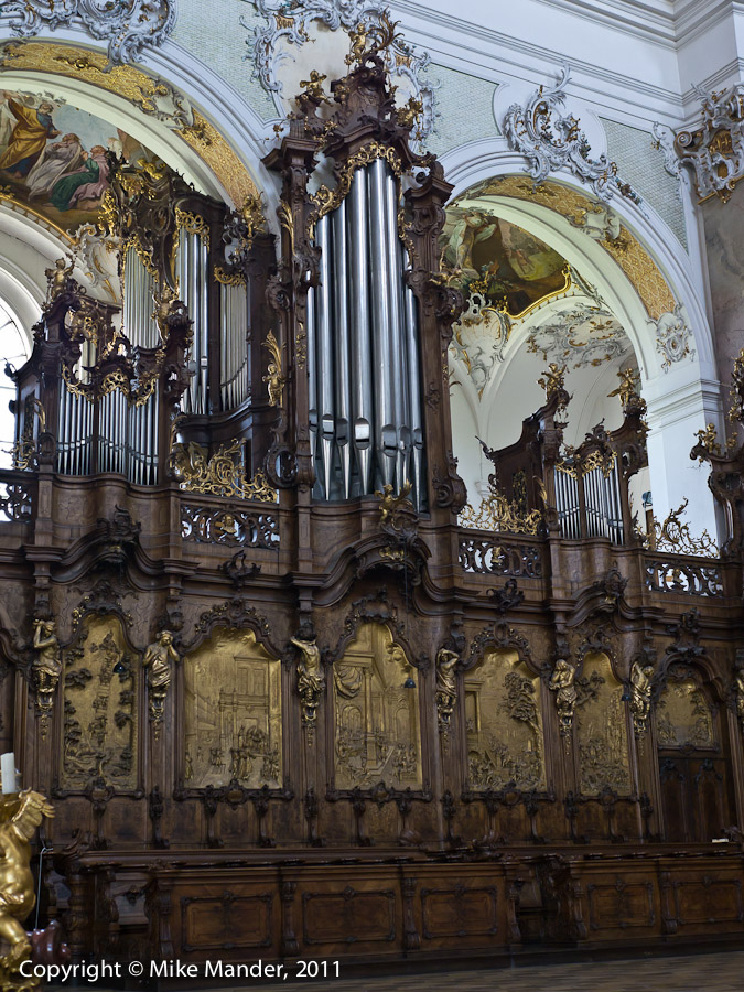
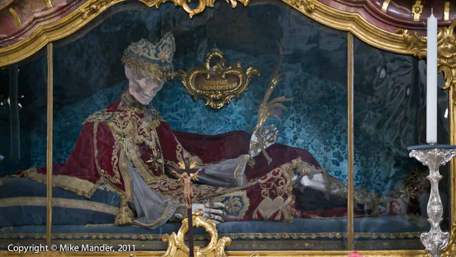
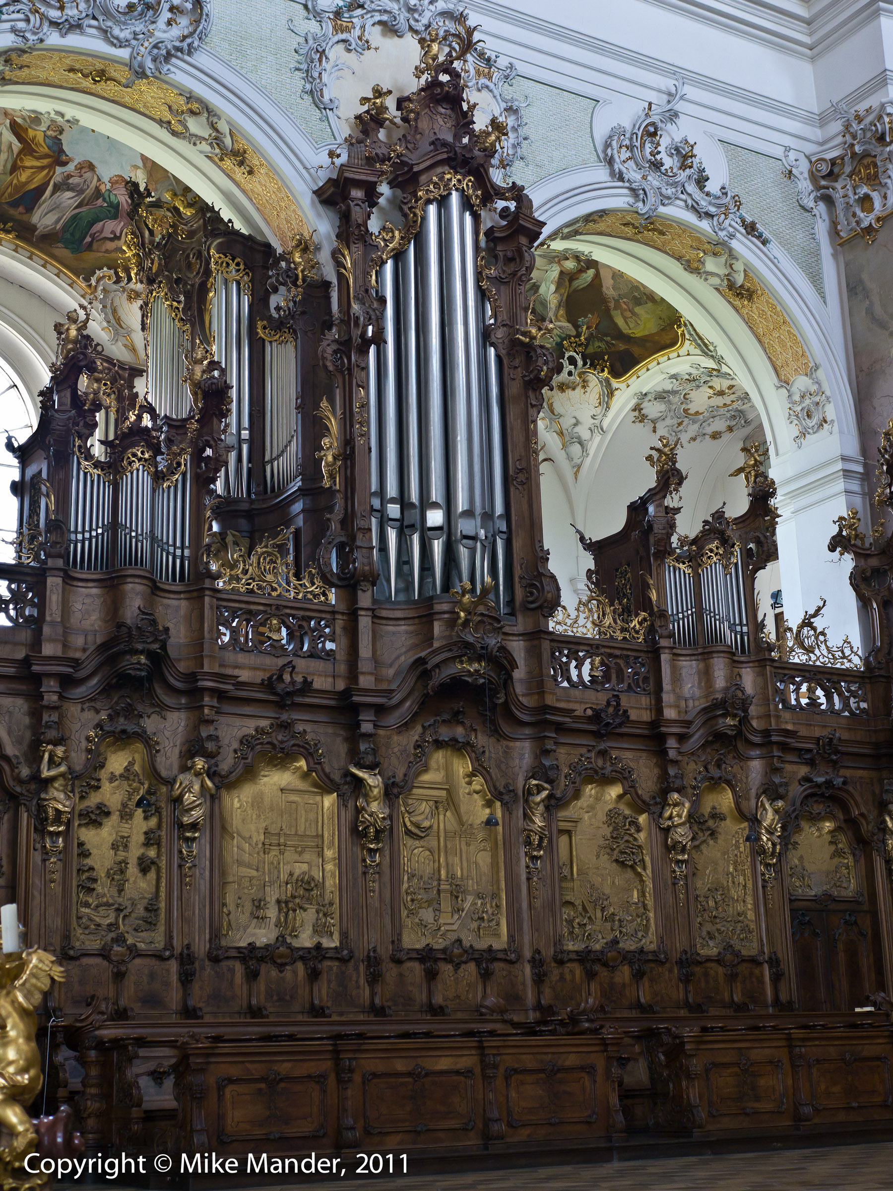
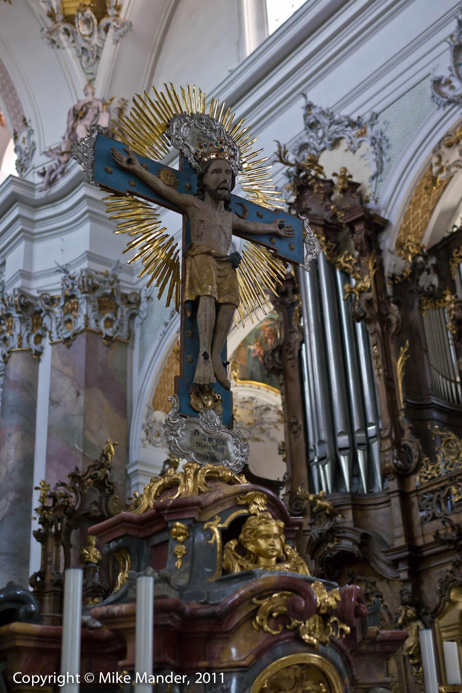
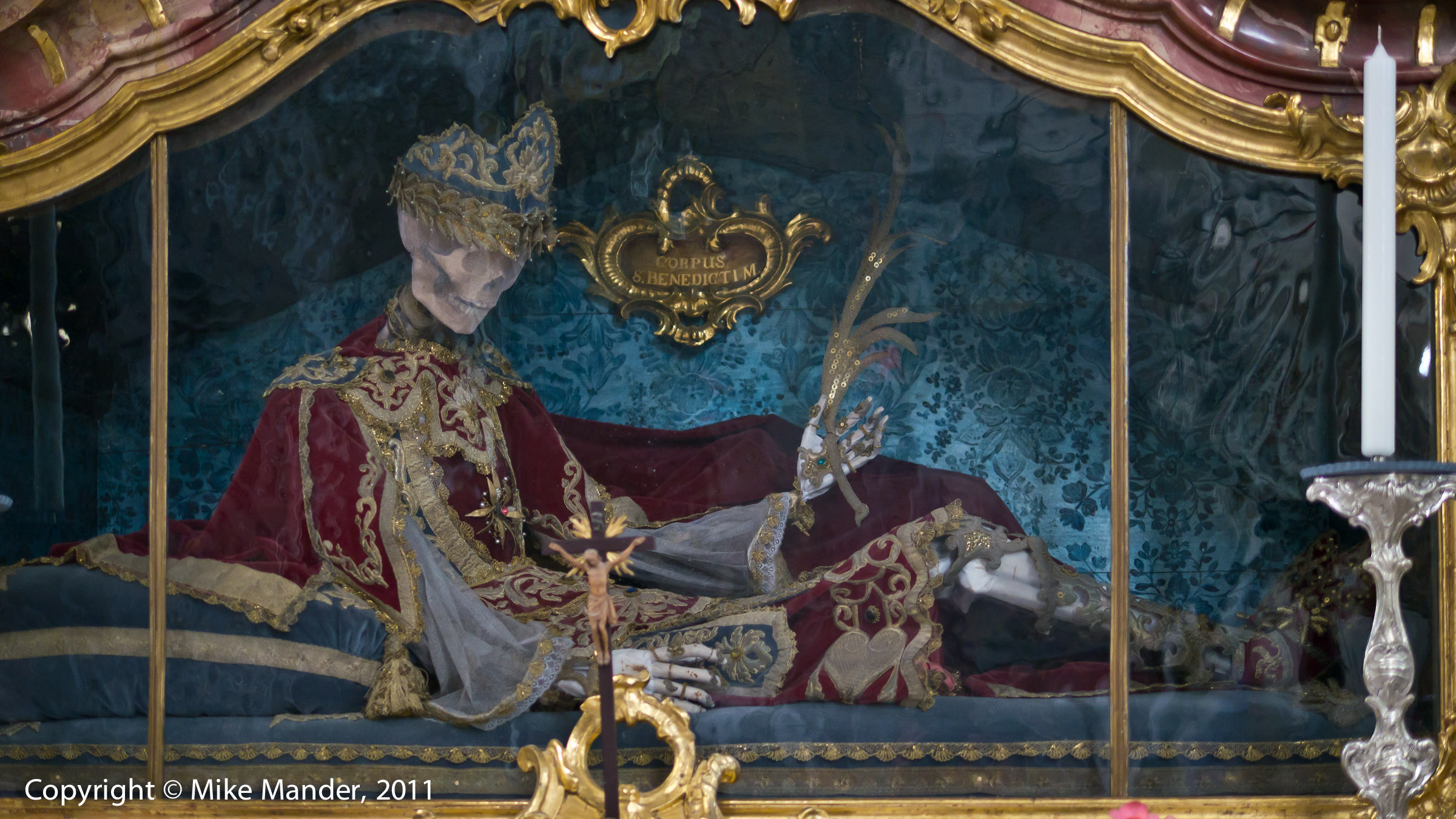
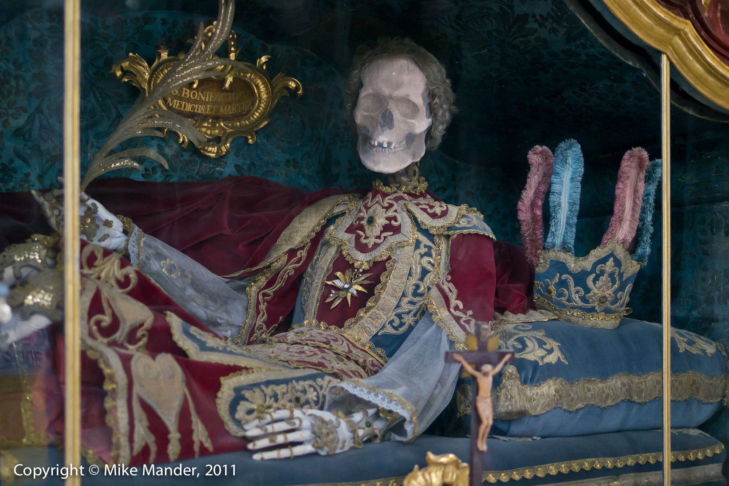
All that gold you see everywhere? Well, it's actualy real. There are even four real human skeletons enshrined, presumably religious figures of importance (photos 13 & 14). Sadly, the central part of the abbey's interior was occupied by scaffolding (visible on the right side of photo 3, looking straight up at the ceiling), in preparation for some restoration work, but there was still so much to see and photograph, it didn't really detract too much from the experience. Lastly, there are three large pipe organs in this abbey, the main one is visible in photos 23 & 29 and one of the two that flank the main altar can be seen in photo 11.

Map

47°56'28" N 10°17'54" E

1/640 sec at f / 8.0

GH2_DE11_03029


    open 2400 pixel version    

1

GH2_DE11_03029

1/800 sec at f / 8.0

GH2_DE11_03167


    open 2400 pixel version    

2

GH2_DE11_03167

Map

47°56'28" N 10°17'54" E

1/25 sec at f / 5.6

GH2_DE11_03040


    open 2400 pixel version    

3

GH2_DE11_03040

Map

47°56'28" N 10°17'54" E

1/25 sec at f / 5.6

GH2_DE11_03048


    open 2400 pixel version    

4

GH2_DE11_03048

Map

47°56'28" N 10°17'54" E

1/25 sec at f / 5.6

GH2_DE11_03049


    open 2400 pixel version    

5

GH2_DE11_03049

Map

47°56'28" N 10°17'54" E

1/125 sec at f / 5.0

GH2_DE11_03059


    open 2400 pixel version    

6

GH2_DE11_03059

Map

47°56'28" N 10°17'54" E

1/100 sec at f / 4.5

GH2_DE11_03063


    open 2400 pixel version    

7

GH2_DE11_03063

Map

47°56'28" N 10°17'54" E

1/250 sec at f / 1.8

GH2_DE11_03067


    open 2400 pixel version    

8

GH2_DE11_03067

Map

47°56'28" N 10°17'54" E

1/80 sec at f / 5.0

GH2_DE11_03069


    open 2400 pixel version    

9

GH2_DE11_03069

Map

47°56'28" N 10°17'54" E

1/60 sec at f / 7.1

GH2_DE11_03073


    open 2400 pixel version    

10

GH2_DE11_03073

Map

47°56'28" N 10°17'54" E

1/80 sec at f / 3.2

GH2_DE11_03079


    open 2400 pixel version    

11

GH2_DE11_03079

Map

47°56'28" N 10°17'54" E

1/320 sec at f / 2.2

GH2_DE11_03084


    open 2400 pixel version    

12

GH2_DE11_03084

Map

47°56'28" N 10°17'54" E

1/40 sec at f / 1.4

GH2_DE11_03090


    open 2400 pixel version    

13

GH2_DE11_03090

Map

47°56'28" N 10°17'54" E

1/40 sec at f / 1.4

GH2_DE11_03094


    open 2400 pixel version    

14

GH2_DE11_03094

Map

47°56'28" N 10°17'54" E

1/180 sec at f / 5.6

X100_DE11_02991


    open 2400 pixel version    

15

X100_DE11_02991

Map

47°56'28" N 10°17'54" E

1/180 sec at f / 2.8

X100_DE11_02999


    open 2400 pixel version    

16

X100_DE11_02999

Map

47°56'28" N 10°17'54" E

1/100 sec at f / 6.3

GH2_DE11_03100


    open 2400 pixel version    

17

GH2_DE11_03100

Map

47°56'28" N 10°17'54" E

1/125 sec at f / 5.0

GH2_DE11_03105


    open 2400 pixel version    

18

GH2_DE11_03105

Map

47°56'28" N 10°17'54" E

1/160 sec at f / 5.0

GH2_DE11_03108


    open 2400 pixel version    

19

GH2_DE11_03108

Map

47°56'28" N 10°17'54" E

1/50 sec at f / 4.0

GH2_DE11_03111


    open 2400 pixel version    

20

GH2_DE11_03111

Map

47°56'28" N 10°17'54" E

1/160 sec at f / 5.6

GH2_DE11_03113


    open 2400 pixel version    

21

GH2_DE11_03113

Map

47°56'28" N 10°17'54" E

1/200 sec at f / 5.6

GH2_DE11_03115


    open 2400 pixel version    

22

GH2_DE11_03115

Map

47°56'28" N 10°17'54" E

1/125 sec at f / 5.6

X100_DE11_03003


    open 2400 pixel version    

23

X100_DE11_03003

Map

47°56'28" N 10°17'54" E

1/125 sec at f / 5.6

GH2_DE11_03121


    open 2400 pixel version    

24

GH2_DE11_03121

Map

47°56'28" N 10°17'54" E

1/60 sec at f / 3.5

GH2_DE11_03126


    open 2400 pixel version    

25

GH2_DE11_03126

Map

47°56'28" N 10°17'54" E

1/60 sec at f / 4.0

X100_DE11_03005


    open 2400 pixel version    

26

X100_DE11_03005

Map

47°56'28" N 10°17'54" E

1/70 sec at f / 4.0

X100_DE11_03009


    open 2400 pixel version    

27

X100_DE11_03009

Map

47°56'28" N 10°17'54" E

1/40 sec at f / 5.0

GH2_DE11_03132


    open 2400 pixel version    

28

GH2_DE11_03132

Map

47°56'28" N 10°17'54" E

1/100 sec at f / 5.0

GH2_DE11_03138


    open 2400 pixel version    

29

GH2_DE11_03138

Map

47°56'28" N 10°17'54" E

1/30 sec at f / 4.5

GH2_DE11_03143


    open 2400 pixel version    

30

GH2_DE11_03143

Powered by The Turning Gate (TTG).

Copyright © Mike Mander, 2011. All rights reserved.


[top]